 手机阅读分享话题
World’s first comprehensive service map usable in no-road and no-network areas launched
2024-09-05 14:51:04
CHONGQING (CQNEWS) -- On September 3, the Aerospace Information Industry International Ecological Conference 2024 was held in Chongqing. At the Conference, China Time and Space unveiled two significant achievements, namely Beidou Scale Application Operating System and Public Beidou 1-meter Precision Positioning Service based on this operating system, marking the beginning of Chongqing’s pioneering efforts in Beidou scale applications and signifying a new phase of marketization, industrialization, and internationalization for Beidou scale applications.
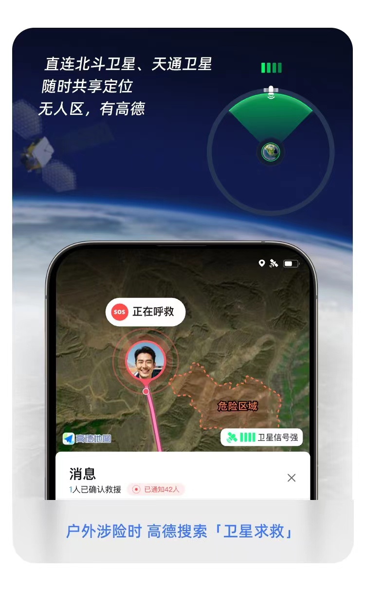
During the conference, the reporter learned that Gaode Map had recently released its new V15, featuring exclusive BDS offline navigation and satellite SOS functions, covering extensive no-signal, no-road, and no-network areas. The new version also introduces a 3D map function that provides clear insights into commercial heat maps, floor guidance, and city dynamics from a micro perspective, marking that Gaode Map becomes the world’s first comprehensive service map.
The V15 upgrade includes six major features, including lane-level navigation, BDS offline navigation, satellite SOS, 3D maps, AI navigator, and performance improvement, catering to diverse user needs across different regions and scenarios.
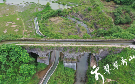
In no-road areas, Gaode Map can track the user’s path and offer a return route along the recorded trail. In emergencies, via the satellite SOS feature, it can send precise location information to rescuers, significantly enhancing rescue efficiency.
For no-network scenarios, Gaode Map has collaborated with mobile manufacturers and satellite communication operators to deliver reliable real-time satellite communication. Leveraging BDS positioning and Tiantong satellite communication, it enables one-click SOS messages.
Under the guidance of the National Academy of Safety Science and Engineering, MEM and the China Academy of Safety Science and Technology, Gaode Map has established China’s first map-based “Rescue Assistance Alliance” with organizations like the Blue Sky Rescue and the Radiance Rescue, combining professional rescue forces with Gaode Map technology to improve efficiency in field rescues.
Additionally, long-distance driving often traverses areas without network signals. If a driver misses an exit due to navigation jams, he or she often has to drive dozens of kilometers more. V15 BDS offline navigation identifies areas with poor network coverage, pre-loads navigation data, and automatically switches to offline mode when signal instability occurs, achieving true universal coverage. Gaode Map offline navigation now covers over a million network risk points nationwide.
To address the complex and unpredictable conditions of highways and expressways, V15 introduces the world’s first lane-level navigation on a map platform.
The key feature of lane-level navigation is its ability to achieve “beyond-visual-range” perception, allowing users to see farther than the naked eye. It is not limited by physical components like sensors and can “see through” surrounding vehicles, providing users with a view of distant road conditions and advance travel recommendations. Lane-level navigation is gradually covering highways and city expressways across China and supports most Android and HarmonyOS phones.
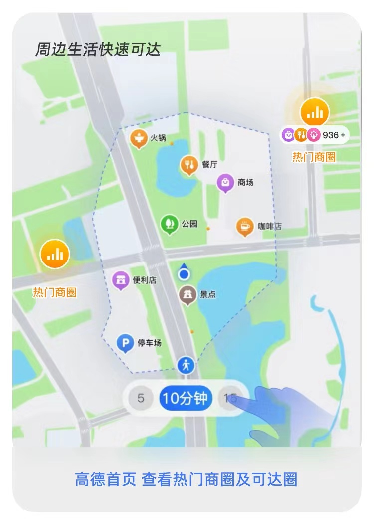
Gaode Map V15 introduces a 3D map with the industry’s first accessibility circle feature. For example, when users search for nearby places, the accessibility circle feature like a mini radar, quickly pinpoint nearby dining, entertainment, and convenience options. The radius of the accessibility circle can be manually adjusted to 5/10/15 minutes walking distance, making it quick and easy to use. When users want to go shopping, surrounding commercial areas are displayed as heat maps, and zooming into these areas reveals detailed information about the shopping areas. Upon arriving at a mall, the 3D map helps users quickly identify their location and view store positions and floor information clearly. (Translated by Vichy, Fathom Language Limited)
Editor:江夷玮